
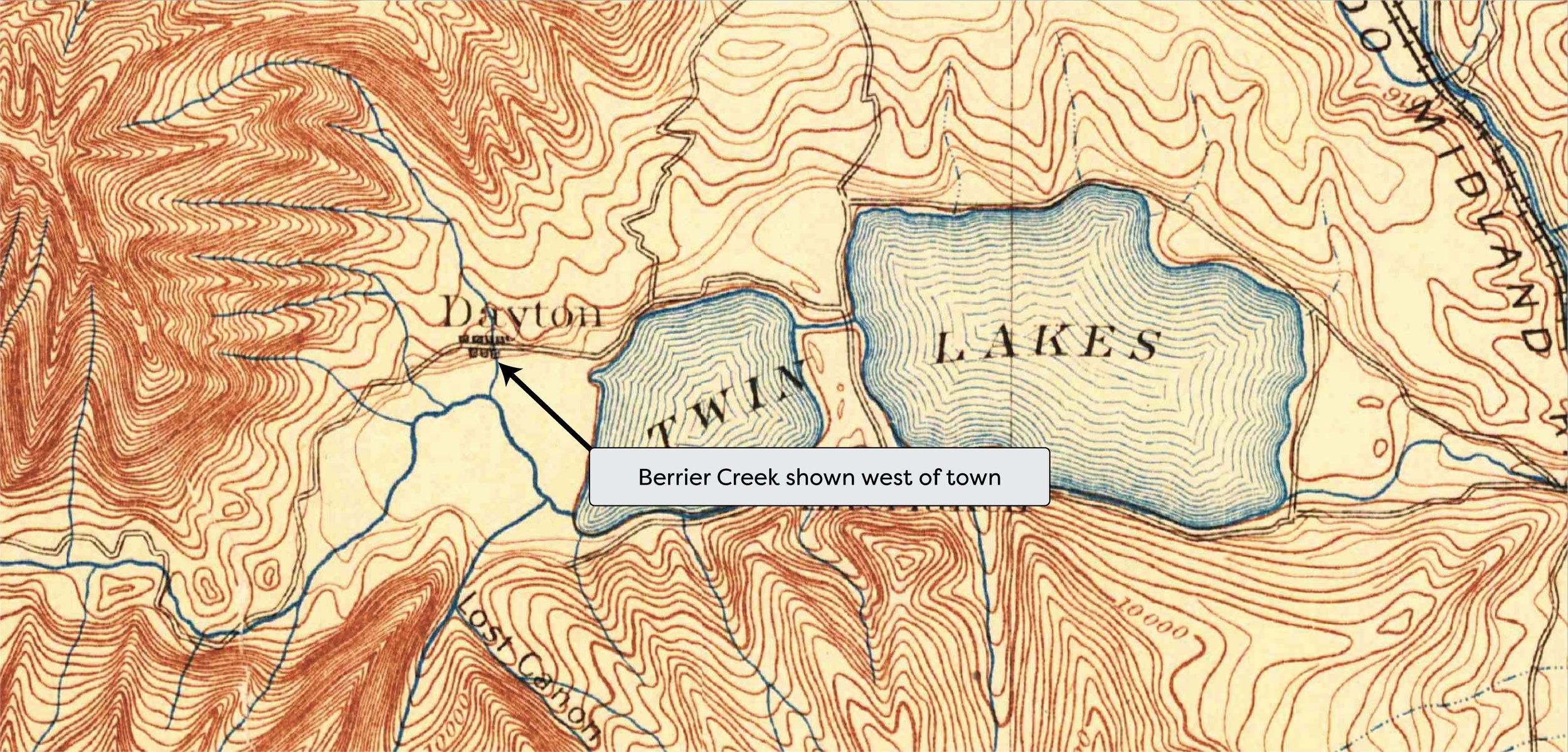
1900 USGS topographical map
This USGS topo from 1900 depicts water from West Bartlett Gulch as flowing southerly through the town of Dayton (now Twin Lakes Village)
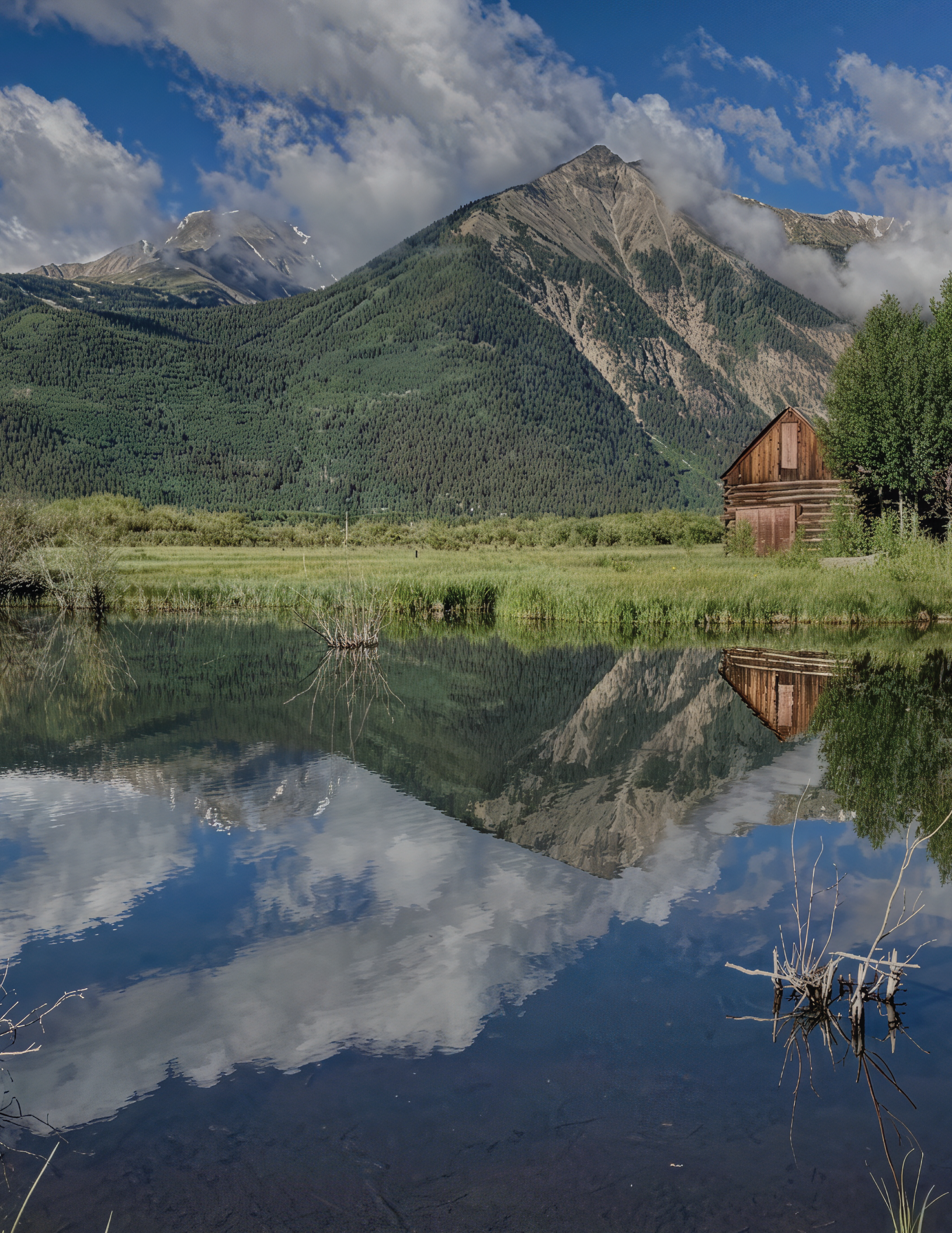
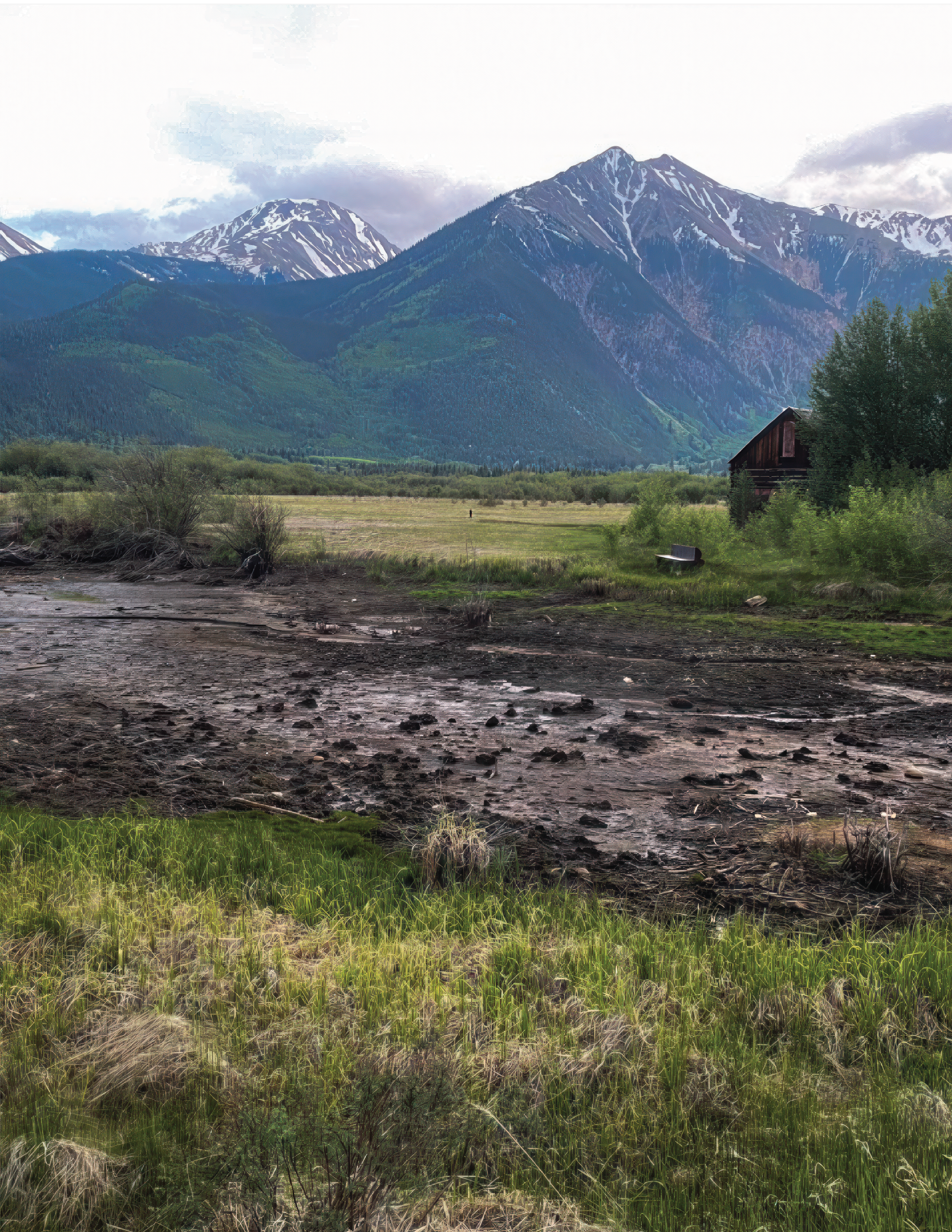
The Barn Pond is an iconic symbol to Twin Lakes Village and a beautiful welcome to the thousands of visitors that come through each year. Even AngelView knows it - the Barn Pond, fully filled and reflecting Twin Peaks is featured on the development’s website. Besides the aesthetic beauty, Berrier Creek feeds acres of associated wetlands, supports residential well resupply and is source of a prospective Fire Mitigation Pond in the Village.

Purchase a Temporary Substitute Water Supply Plan (TSWSP) through the State Engineer's Office. The only likely game in town for that is Pueblo leasing 5 acres for $10k/year.

Redact the Aug. 5th DWR determination that states Berrier Creek is a ditch. Lake County has senior water rights which flow down the natural channel of West Bartlett Gulch.
This USGS topo from 1900 depicts water from West Bartlett Gulch as flowing southerly through the town of Dayton (now Twin Lakes Village)
Here we see the flow of West Bartlett Gulch referred to as Berrier Creek before draining into Twin Lakes.

This Town Plat from 1880 details the flow of Berrier Creek through the Village

The Denver Post
Leadville Herald
If you love the beauty of the Barn Pond, you can help us out by donating. We will use donation money for the following purposes:
If possible, purchasing a water lease from City of Pueblo to augment water to the pond.
Fees for running our website, and printing informational materials
If you have additional resources, want to write an article, or have general inquiries/advice/support, please contact us at savetwinlakesbarnpond@gmail.com
by Megan Byers